


Natural Hazards
Natural hazards such as bushfire, flood, storms and coastal hazards can threaten lives, property, infrastructure, the community and industries, and our natural environment.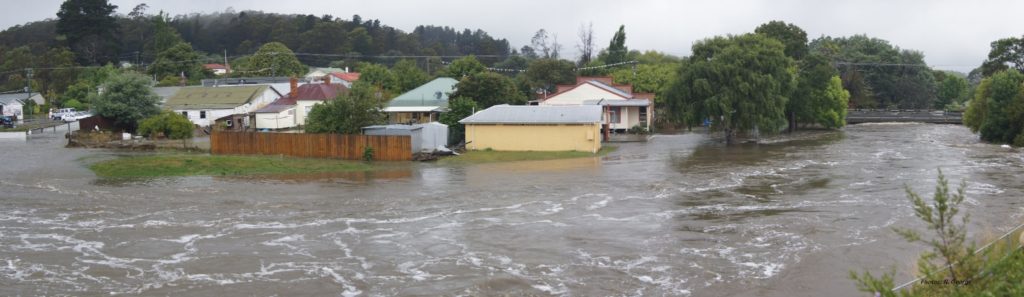
We play a role in helping individuals and communities, businesses and governments to manage the risks they face from exposure and their vulnerability to natural hazards. We also work to understand and plan for them, including with Climate Change. And to manage the risks and oppoprtunities for Council, and the municipality’s community, economy and environmental values.
We are part of the national networks for Emergency Management, Response, Recovery and Resilience. Working with the State Emergengcy Service (SES) and their services, such as TasAlert. Council also has a responsibility through Tasmania’s Planning System to reduce future risks, and avoid land use and development putting lives, important infrastructure, property, our economy and the environment at risk.
We’ll progressively add more Natural Hazards content here over time.
The beaches, dunes, rocky headlands, tidal reefs and estuaries we treasure are shaped by coastal processes, powerful forces of nature between land and sea. Shorelines erode and retreat and expand with deposited sediments. Tides can inundate land with storm winds and waves and sometimes combined with effects of floodwaters from inland.
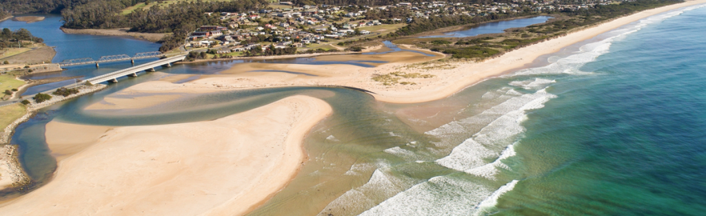
Climate change is projected to change these processes and the coastal hazards they can pose. More intense and frequent extreme weather events and gradual sea level rise under storm events will and mean the coastlines we visit and like to live by will change. Coping and adapting to coastal hazards can be in terms on protection, accommodating them, and retreat (or not being in their way in the first place).
Council has roles in sharing coastal hazard information, planning to avoid the risks and loss, emergency management, helping the municipality address coastal risks and adaptation, and engaging with the state national governments in coastal hazard management.
We must also manage the risks to our assets and services like roads and stormwater drianage when they are exposed and vulnerable to coastal hazards. Similarly, residents, businesses, the community and users of coastal open spaces and other governments and agencies, such as the Parks and Wildlife Service who manages most coastal land and habitats, Taswater and Building Tasmania, face coastal hazard risks of their own.
We all share a responsibility to manage our own risks and adapt to uncertain and increasing coastal hazards. Which means we share the challenge of adapting to coastal hazards with climate change.
Coastal Hazards Information
- Coast Adapt, an online resource on coastal adaptation
- Coastal hazard management by Tasmanian Government
- Coastal Hazard Bands map on LISTmap
- Principles of the Department of Natural Resources and Environment Tasmania (including the Parks and Wildlife Service) for planning, decision making and engagement on Coastal Hazard management
- Tasmanian Coastal Adaptation Pathways program 2018 – Georges Bay pathways (2012, PDF)
- Southern Councils coastal adaptation strategy (2022, PDF)
_______________________________________________________
CASE STUDY – Scamander River mouth
The Coastal Hazards and Flood Risk Adaptation Pathways Project provided an opportunity for the local community and business and government agencies to understand the coastal and flood hazards at play at the Scamander River mouth and plan future management. What was learnt about the natural processes driving them, risks faced, past management, future outlook, and the ‘pathways’ adaption planning work it did, is of value there and for other coastal communities.
Coastal erosion and inundation risks are an inherent part of the River mouth with high seas or heavy rain and river floodwaters, and increase if they combine during extreme weather events. And Climate Change is projected to make things worse, and uncertain.

The community, River mouth residents and government agencies and other stakeholders participated in the project with Council. It evaluated some options for risk mitigation and adaptation actions and ‘adaptation pathways’ for managing the coastal hazards and risks. It also undertook some ‘no-regrets’ mitigation works to reduce immediate shoreline erosion risks at the River Mouth.

Coastal and Flood Hazards at Scamander
The first stage of the project produced an Outlook report – Scamander Coastal Hazards & Flood Risks, which reviews coastal and river processes, the hazards they pose, implications of climate change and management practices. It also looked at existing assessments and mapping of the hazard risks. This study is a takes a look at coastal processes and implications experienced by many parts of the Break O’Day coast.
We have summarised the Outlook Report here, and you can download the full Outlook report – Scamander Coastal Hazards & Flood Risks here.
Natural Processes
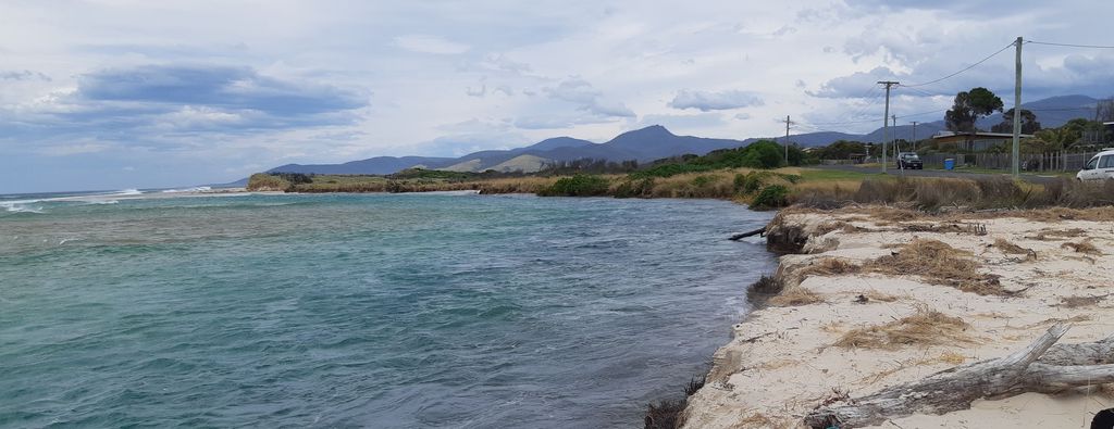
River Mouth Dynamics: The Scamander River is an ICOLL (intermittently closed and open lake/lagoon) system, with a sand berm periodically closing the mouth. The entrance migrates naturally along the coast.
Wind, Tides, Waves: Seasonal wind patterns, microtidal conditions, and exposure to Tasman Sea storms influence sediment transport, berm formation, and coastal erosion.
River: The Scamander catchment produces significant flood events that can develop rapidly. High river flows rise to breach the berm when it is closed and reshape the mouth channels.
Sediment Transport: Beach sand is regularly reworked on the coastline, with episodes of both northward and southward longshore drift occurring. Sand comes and goes in the mouth forming shoals (extending to under the bridge), meandering of channels and the beach berm.
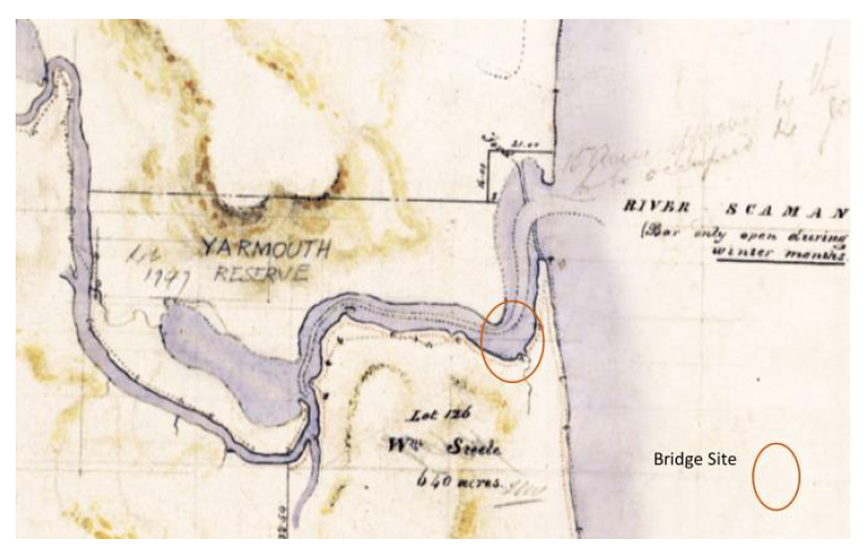
River Mouth History: Records show the Scamander River entrance has migrated up and down the coastline over time, typically 500m, but up to a 1500m range. Beach shorelines have also moved. Human activity has affected the mouth, such as the old training wall which restricted southward entrance migration from the 1990s, until about 2015.
Climate Change: These natural processes are expected to intensify—raising the beach berm, increasing flood inundation, accelerating shoreline retreat, and shifting the river mouth inland.
Hazards
Coastal Erosion: Short-term and long-term erosion affects beaches and estuary banks, driven by waves, tides, and sea level rise.
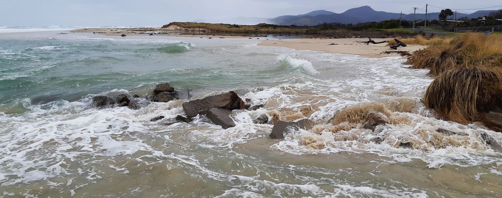
Estuary Foreshore Erosion: Varies with entrance conditions; some areas protected by revetments, others exposed.
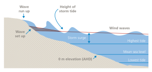 Coastal Inundation: Caused by high tides (sea level), storm surge and wave runup and is worst when they occur together.
River Flooding: Produced by rainfall in the river catchment heavy enough to spill over the banks of watercourses. The barway being closed or open significantly affects inundation levels and roads and property are impacted by floods.
Coincident Events: Hazard impacts amplify when coastal and flood hazards coincide – such as in March 2021. It is difficult to assess the likelihood of coincidence and the increased compound risks.
Implications of Climate Change: Increased rainfall intensity, stronger coastal storms and sea-level rise (0.92m by 2100) are projected to exacerbate river flooding and coastal erosion and inundation. Soft shorelines could retreat 10m of for every 0.2 m sea level rise and the River’s ICOLL features and process would be unsettled.
Hazard Assessments
Existing Studies and Mapping: Tasmanian studies to evaluate and map coastal erosion and inundation and river flood risks have produced useful assessments for long term adaptation planning for Scamander and are they applied by Tasmanian Planning Provisions. In reviewing the studies for the River mouth several limitations have been identified.
Coastal Erosion: Didn’t account for wave runup, barway-berm dynamics and entrance migration. Risks at Dune Street in particular are underestimated, which was threatened by erosion in recent years [late 2022] when the mouth channel moved close to the Street.
Coastal Inundation: Underestimates risk by not including wave setup and runup (which are affected by the barway being open/closed) and interaction with river floods.
River Flooding: The Tasmanian Strategic Flood Mapping project provides the best available data for the river mouth. However it doesn’t account for the interaction of sea storm surge and waves with flood waters, or the state of the barway and when it is closed the height of beach berm.
Management History & Practices
Training Wall (early 1990s-2015): Initially effective but now failed due to storm damage and no longer controlling entrance channels.
Bridge Abutments: Still effective in controlling scour since bridge construction (1991).
Foreshore Protection: Rock revetment have been placed on northern and southern foreshores. Rock revetment placed in the early 1990s to protect the south bank adjacent to the park has been effective but is starting to degrade now. On the north bank (Pelican Sands) rock works 20-30 years ago have been collapsing progressively. Some informal protection has been applied more recently.
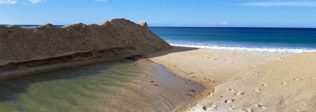
Entrance Opening: Council manually opens the barway if closed, inundation levels rise and/or heavy rain is forecast—success varies with the dynamics of the river mouth and its coastal processes.
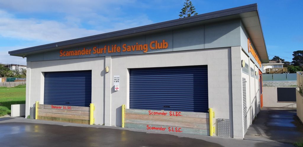
Local Mitigation: The Scamander Surf Life Saving Club has applied mitigation and adaptation measures for it’s club building after inundation and storm wave impact.
_______________________________________________________
Adaptation Planning
The project developed a Scamander Coastal Hazards and Pathways Adaptation Plan by overlaying maps of assets and values with the coastal/flood risks for a cost/benefit analysis of mitigation options. Cost and limited and uncertain benefits favour modest management interventions to avoid maladaptation before future hazard risks are clear.
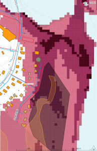
The Plan found coastal hazard risks were underestimated on existing mapping and planning controls needed improvement for future use and development to avoid risk and losses. It recommended no-regrets works to mitigate short-term risks – some being implemented by the project. The Plan also outlines ‘adaptation pathways’ to work on in the meantime, to meet medium- and longer-term risks, including considering retreat.
The Scamander Coastal Hazards and Pathways Adaptation Plan is a shared resource for shared risks. Its background investigations and adaptation pathways approach can be useful for others elsewhere, beyond people and agencies facing coastal hazards at Scamander.
View and download a copy of the Scamander Coastal Hazards Pathways Adaptation Plan here.
Works to reduce immediate risks
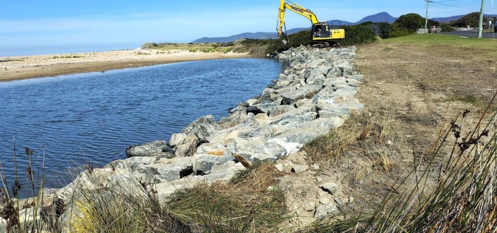
The Scamander project also undertook some erosion control works in August 2026 to repair the degraded rock wall (revetment) in front of Scamander River mouth park and stabilise an erosion bank next to Dune Street. Over 200 tonnes of rock and 200m of geotextile were used to treat around 150m of shoreline. These works aim to control erosion and hold the shoreline position in the short-term. They are not providing protection from inundation by floods and high seas.
To improve management of a closed barway an automated water level sensor has been installed on the Scamander bridge. With monitoring of barway height when the mouth closes, it will help decide on artificial opening of the barway to reduce the risk of inundation during floods and storms. And it will give warning of high flood levels, that can also occur with an open River mouth.
________________________________________________________
‘ICOLLs’
Scamander estuary and river mouth is a member of the Intermittently Closed and Open Coastal Lakes and Lagoons (ICOLLs) that many communities on Australia’s east coast live by and know well. The NSW Department of Planning, Industry & Environment has produced an information guide that provides “technical background to the factors controlling entrance dynamics of intermittently closed and open lakes and lagoons (ICOLLs), how entrance dynamics affect water quality and ecology, and the likely consequences of different management interventions. “
This ICOLLs information guide is a useful resource for understanding the dynamics of the Scamander River Mouth and its barway.
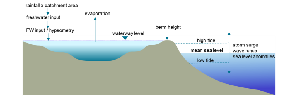
NSW and Department of Planning, Industry and Environment 2021 – ICOLLs webpage
Scientists from the the Institute for Marine and Antarctic Studies (IMAS) and Climate Futures Tasmania (both at UTas) came to St Helens on 18 June 2026 with a community information evening.
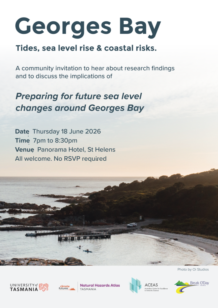
Around 30 people attended presentations and joined in discussion on a tide gauge project in Georges Bay and sea level rise risks, and on the Natural Hazards Atlas Tasmania.
Karen Palmer shared findings from a tide gauge project that included Georges Bay, research into future sea level rise, its implications for the Bay and coastal hazard risks. We also heard from Annabel Bowden from the Climate Futures team on current work developing the Natural Hazards Atlas, an online resource.
Georges Bay has significant fisheries, settlement and community values around it and flooding from the catchment meets tides, storms and future sea level rise. Discussion during the evening is helping inform a case study being prepeared for the Natural Hazards Atlas Tasmania.
Slides from the two presentations can be viewed and downloaded with the links below. There is also an audio recording of the presentations (but not discussion). And links to access the report and data from the Tasmania tide monitoring project ( which included three gauges at Georges Bay) and the Natural Hazards Atlas project.
- Georges Bay Tides, SLR & Coastal Risks presentation
- Natural Hazards Atlas Tasmania presentation
- Recording of presentations – audio with slides (36Mb. 33 minutes. ‘Tides’ from 1:30, ‘Hazards Atlas’ at 24:10 min.)
- Tasmania tide monitoring project report and data, from the Institute for Marine and Antarctic Studies (IMAS)
- Natural Hazards Atlas project